The overaching goal of the project is to develop methods for the detection, quantification and monitoring of methane point emissions using high-resolution hyper- and multispectral satellite data.
Specific objectives:
Assess the potential and limitations of spaceborne hyperspectral and multispectral missions:
Quantify detection limits and uncertainties for quantitative methane mapping with hyperspectral data.
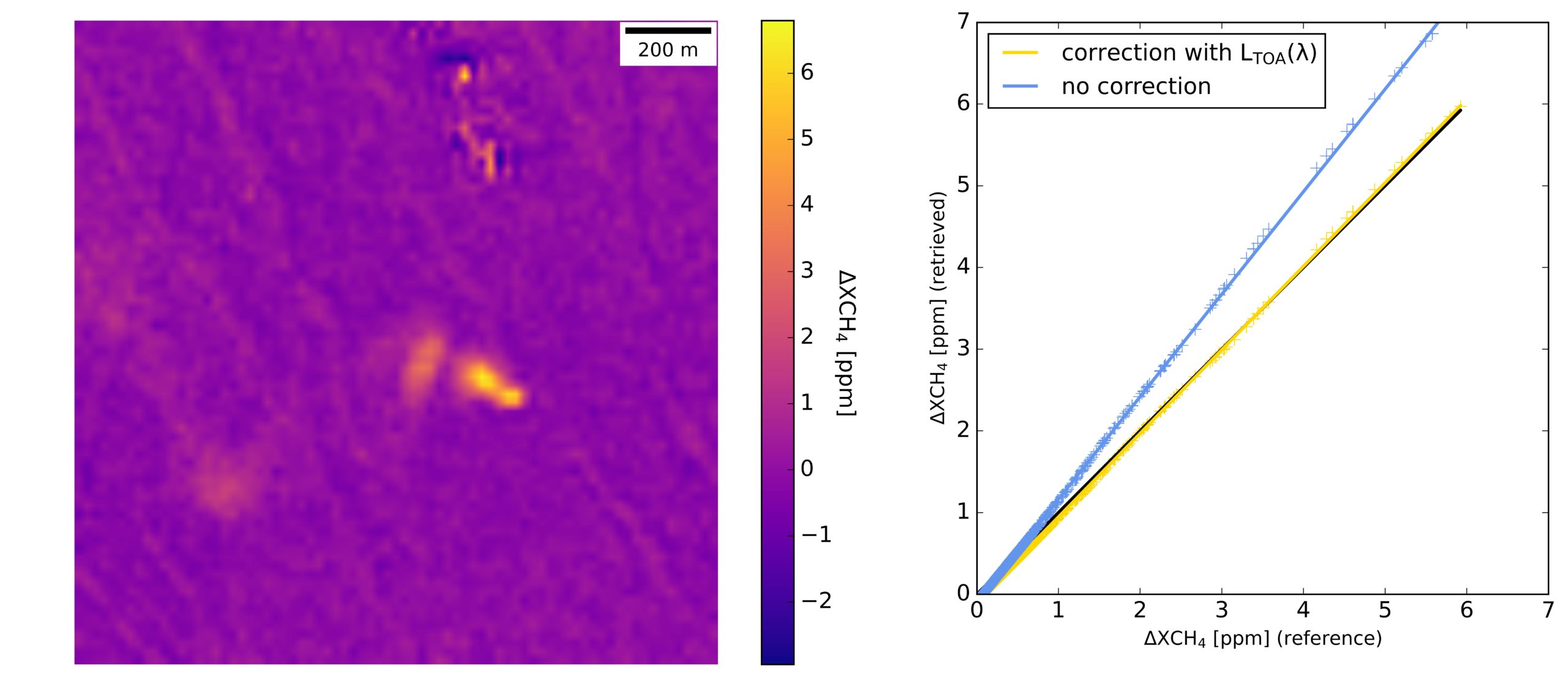
Evaluate the sensitivity of multispectral missions (S-2, Landsat, and WV-3) for methane point emission detection –> Improve retrieval methods.
Define potential synergies between high-resolution hyperspectral and multispectral data for methane mapping.
Required tasks:
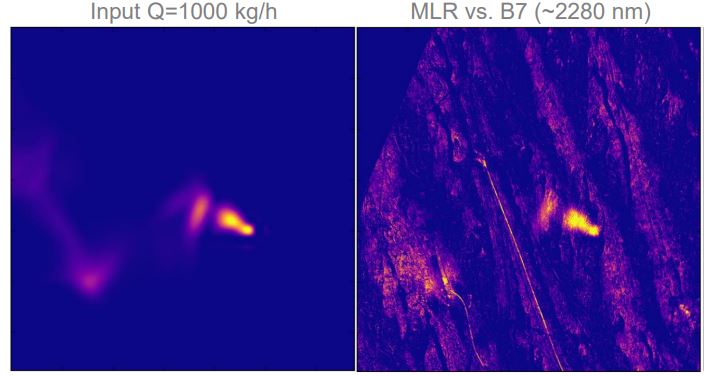
Implementation of a realistic L1B scene simulator.
Design of new retrieval methods & methane detection limits for both hyper- and multispectral data.
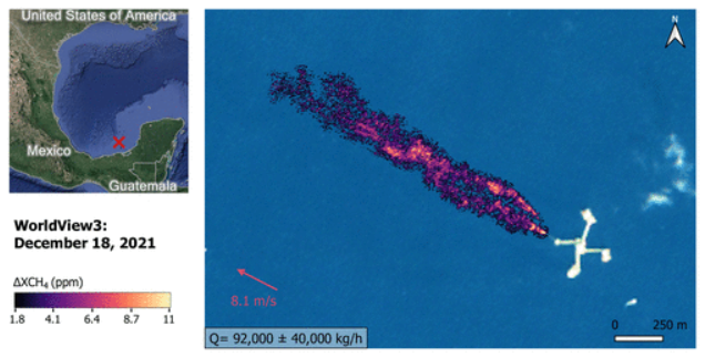
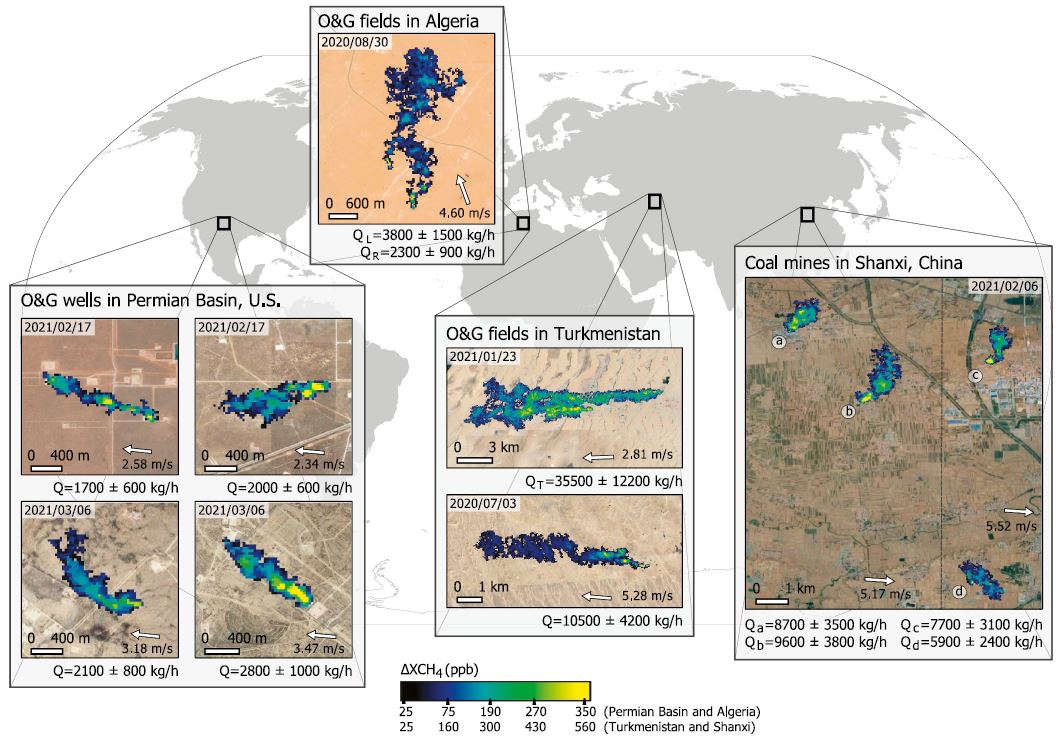
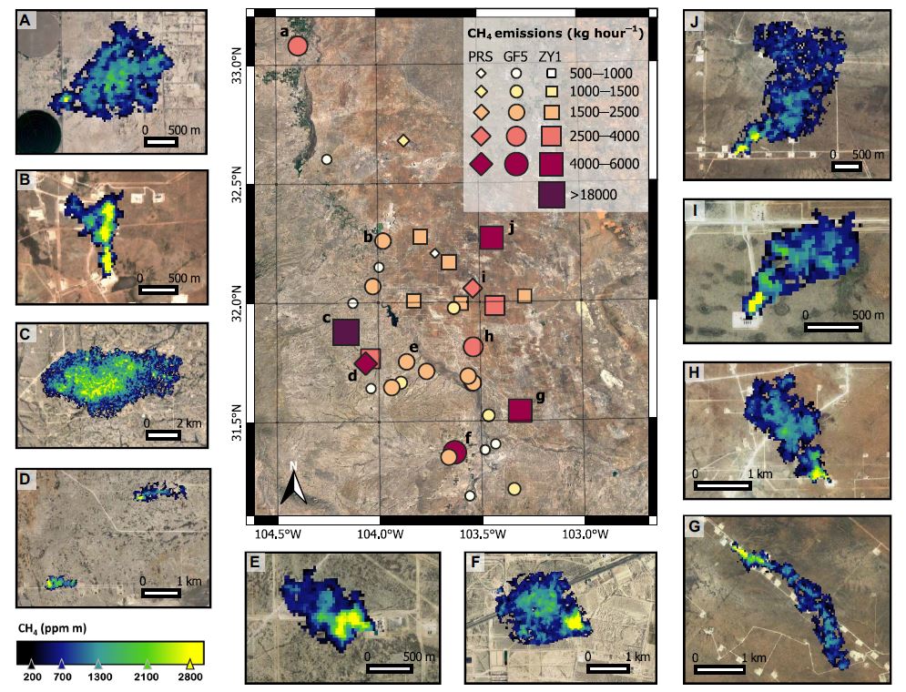
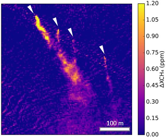
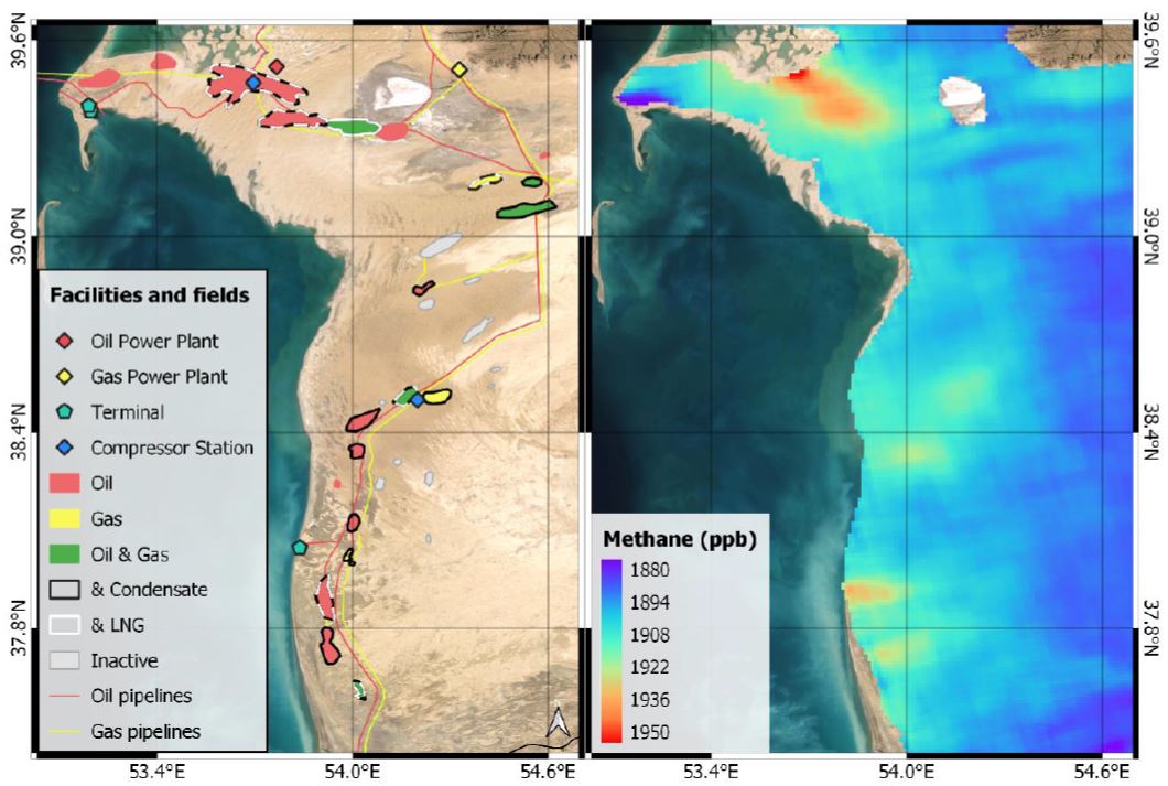
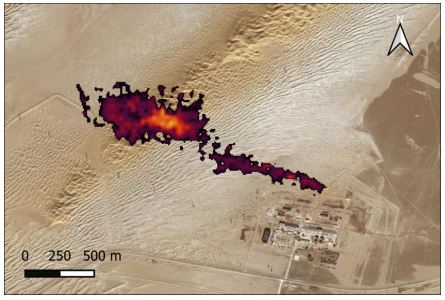
Successful data analysis over several O&G producing areas from which no high-resolution methane emission survey has been previously performed.
Mapping of methane point source emissions at very high spatial resolution can be of great support in the global methane reduction activities to mitigate climate change.